Sam Godin is a university teacher living in Kanagawa, Japan with a strong passion for photography. Follow Sam on Instagram.
There are around 16,600 mountains in Japan, give or take a few. That's more than double the amount of mountains in California, which is almost the same land size as the island nation. It's an astounding fact, and it also makes planning a hike in Japan anywhere besides the ultra-famous Mt. Fuji an overwhelming prospect.
If you're after a day hike while visiting Tokyo, there are some amazing mountains in the Okutama and Tanzawa areas that offer impressive views of Mt. Fuji, but some of the best ridgelines to hike can be found north of Tokyo in the prefectures of Nagano, Toyama, and Gifu. These mountains are known collectively as the Hida Mountains, or, more commonly, the Northern Japanese Alps.
What follows is a comprehensive, first-hand account of hiking the Hida Mountains. Scroll on, dig in, then book your own trip now that travel to Japan is back on the menu!
What to Know About Hiking in the Japanese Alps
The Northern Alps are home to a network of trails and huts that give hikers of all ages and skill levels access to everything they need to adventure comfortably at elevation for days or weeks at a time. Hiking in the alps is like a choose-your-own-adventure book: just pick a starting point and an endpoint and there will almost certainly be a route you can take.
The hiking trails are mostly well maintained and there are an abundance of signs and postings to guide you, plus a surprising amount of ladders and chains to help out when navigating tricky sections.
While there are populations of black bears in the mountains, you will not need a bear canister—usually having a bear bell or talking with a hiking partner is enough to keep them away. You may find yourself face-to-face with wild monkeys as well, just be sure to give them their space and not to get too close.
Weather
Weather in the mountains is known to change rapidly thanks to the geographical location of the mountain range between the Sea of Japan and the Pacific Ocean. If bad weather does strike, finding a last-minute exit point is fairly easy, as the ridgelines are full of access points. Being able to hop into the mountains at one point, and then exit and be able to make it comfortably back to civilization without too much hassle is a testament to how versatile the accessibility of hiking in the Japanese Alps can be.
When to Visit
Generally the best time to hike in the Northern Alps is when the hut system is open for business, which is from late April to early November. The times change depending on what elevation you plan to hike at—anywhere that receives a lot of snow won’t have any open huts along the hiking routes by November.
This is not to say you can’t go in the winter. Some of the best backcountry skiing and snowboarding can be found around the alps, especially in the Northern Alps, but you'll need to go prepared with your own backcountry kit.
If you can, plan a hiking trip during the fall when the mountain foliage starts to turn colors and the peaks explode into an awesome assortment of reds, oranges, and yellows (usually starting in early October). Autumn attracts many hikers from all over Japan, so expect the tent sites and huts to be more crowded around this time of year.
Tips for Planning a Trip to the Japanese Alps
Make Reservations
Even if you plan on staying in a tent site and not sleeping in the huts, it is best to check and see if you will need a reservation or not. After COVID-19, many huts have switched to a system of reservations only, and there are few if any spaces to pitch a tent besides the designated sites. Sometimes you can accomplish this online from their website, but some of the websites are fairly old and you’ll have to dig around for the information on whether a reservation is needed or not. Google Translate is your close friend in this case, but a few short Japanese phrases can get you through a phone reservation as well.
How to Check the Weather
This can be said of any hike in mountainous regions around the world, but the weather can change rapidly in the Japanese Alps. It's worth checking the weather often before the day of your hike. There are a few websites, like Supercweather or Tenkura that can give fairly accurate and detailed weather forecasts for Japan specifically, as well as Mountain Forecast.
Bring Cash
You will be hard pressed to find anywhere that accepts credit cards in the mountains of Japan. Cash can buy you a hot meal at a hut or some souvenirs to celebrate the hike. You’ll often have to pay for water refills at the various huts as well if you aren't staying there. If you are in a tight spot with weather and need to stay at a mountain hut (typhoon season in Japan overlaps with the hiking season), you'll definitely need some cash with you.
Plan Your Transportation
Just rolling up to the trailhead and hiking can be a viable option in Japan's Alps, but you will want to plan your trip carefully to make sure you make bus times and train times. If you're without your own transportation, you’ll need to rely on Japan’s very punctual and vast public transportation system. Websites like Google Maps and HyperDia are two good ways to plan your transportation. Part of why hiking is so popular in Japan is that it's so easy to get to the mountains and back using trains and buses. If you do find yourself late for a bus, hitchhiking is another way to get back to town, although not the most reliable.
What Gear to Bring to Hike in Japan
Tent & Sleep System
If you plan on staying in the mountains for a traverse or more than a few days, consider utilizing the many tent sites instead of staying in the huts. The Japanese hut system ranges in amenities from single room shelters to full on four-star hotels with baths and everything, but they all cost a pretty penny. They can range from ¥7,000 to ¥17,000 (~$47 to $115) with meals, which adds up if you plan on hiking for four or more days. Using a tent on the other hand can let you stay at the tent sites for under ¥2,000. Either bring your own food or get to the tent site early enough in the day to take advantage of the meals often offered at the huts.
A Map
The network of trails in the alps can be overwhelming, and a wrong turn at a junction can set you back hours. It's hard to get completely lost with how well marked the trails are, but it can be easy to get turned around when most signs are in Japanese. Consider bringing a paper map or downloading one of the many map applications that YamaReco has for the Japanese mountains. Even if they are in Japanese, they can be useful for knowing where you're going.
The Yama to Kogen map series is wonderfully detailed and usually has up-to-date information about trails and transportation.
Rain Gear
Be prepared to get rained on, especially if you plan on staying for an extended period of time in the mountains. Avoid stuffy rain gear and try to find something breathable—the mountains in Japan can be pretty humid, especially at lower elevations. On my latest hike, I opted to ditch my Gore-Tex-lined hiking boots and go with a pair of light and breathable trail running shoes that dried quickly even after being drenched with rain in the middle of the day.
A 4-Day Hike Itinerary in the Japanese Alps
Recently, my friend and I planned a six-day traverse through the Northern Japanese Alps that started in Nagano prefecture and ended in Toyama prefecture. Our plan was to traverse the Northern Japanese Alps, south to north. We started at the trailhead for Mt. Tsubakuro, a popular day hike and starting point for the busy Omoteginza Route, though you could start from a number of other points such as the small city of Kamikochi, Nagano, which is another well-suited (and busy) point to begin hiking.
The idea was to end on Mt. Tsurugi, one of the tallest mountains in Japan and arguably one of the more dangerous climbs, but weather forced us to descend early at Mt. Yakushi on our fourth day, about 23 kilometers south of that point. Here's what our final route looked like.
Day 1: Nakabusa Onsen Trailhead to Daitenso Hut 9 kilometers, 1,660 meters total elevation gain
Day 2: Daitenso Hut to Sugoroku Hut 15 kilometers, 1,200 meters total elevation gain
Day 3: Sugoroku Hut to Yakushi Pass Campground 18 kilometers, 1,190 meters total elevation gain
Day 4: Yakushi Pass Campground, Mt. Yakushi, Oritate Trailhead 13 kilometers, 690 meters total elevation gain
While the major peaks we crossed—Mt. Kurobegoro, Mt. Yari, Mt. Yakushi—were obscured by cloud cover when we reached the summits, Japan's weather gods did grant us a few bits of sunshine and views throughout the hike. We had plenty of wildlife encounters too, including some close calls with mountain monkeys that were not so happy that we were hiking through their territory. We also came across some raicho, which translates to “thunder bird” in Japanese. They are a type of mountain grouse and it's said to be lucky if you catch a glimpse of one. Unfortunately, that luck didn’t translate to better weather conditions for us!
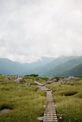
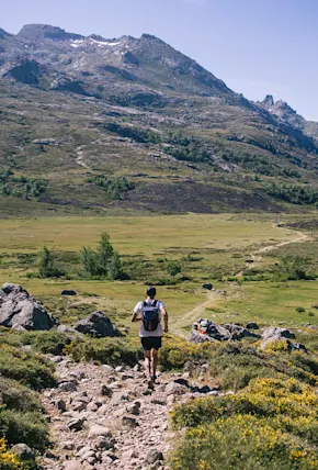
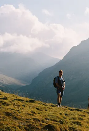
Scroll on below for more film photography from our hiking trip in the Japanese Alps.
Published 11-15-2022